Everything you need to stay informed
Powerful features designed to help you monitor river levels and flood conditions with ease.
Full iOS Support
Native user interfaces optimized for Apple iPhone and iPad devices with full support for all screen sizes.
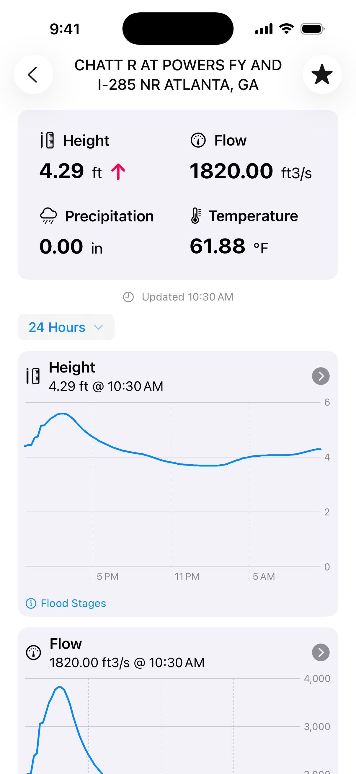
Real-time Data
Leverages USGS real-time data to provide the most current and accurate stream gauge information available.
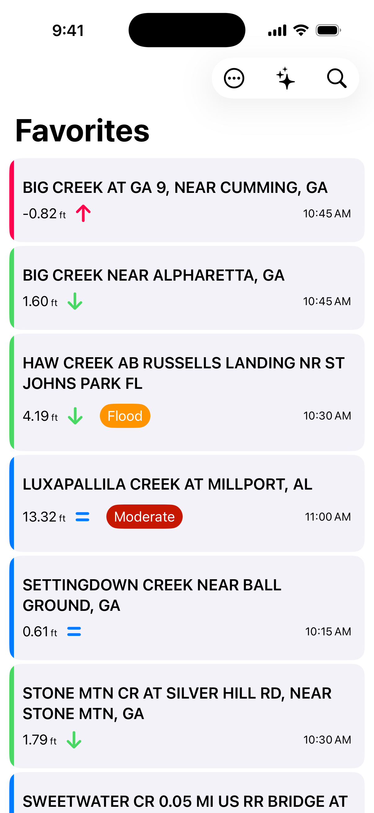
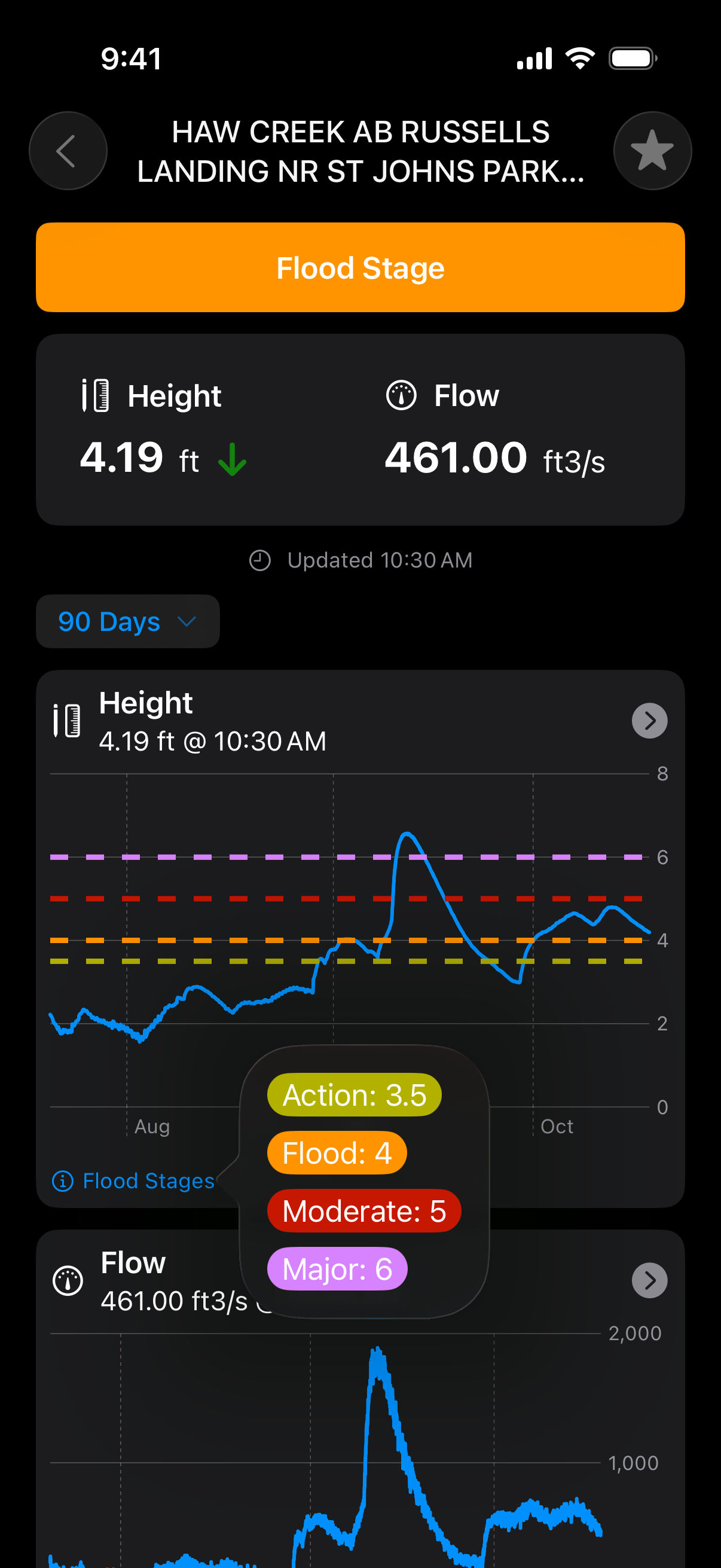
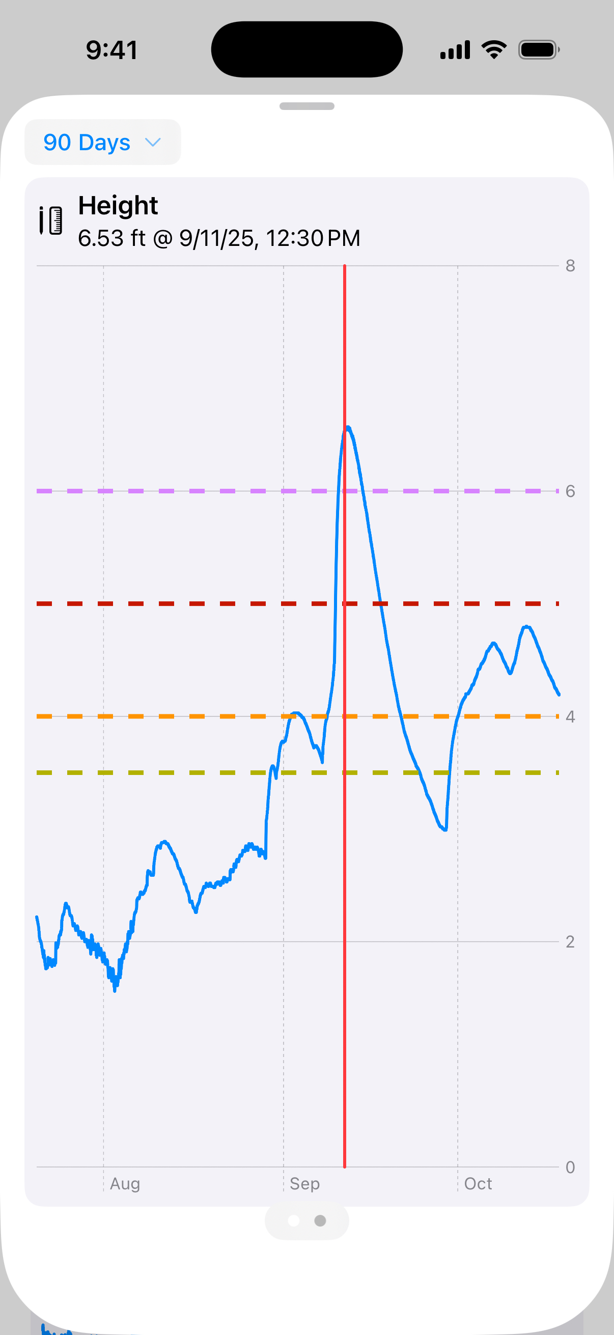
Flood Stages
Identify gauges approaching or at flood stage levels using National Weather Service flood stage data.
Historical Trends
View gauge height, flow, precipitation, and water temperature values over the past 90 days to spot trends.
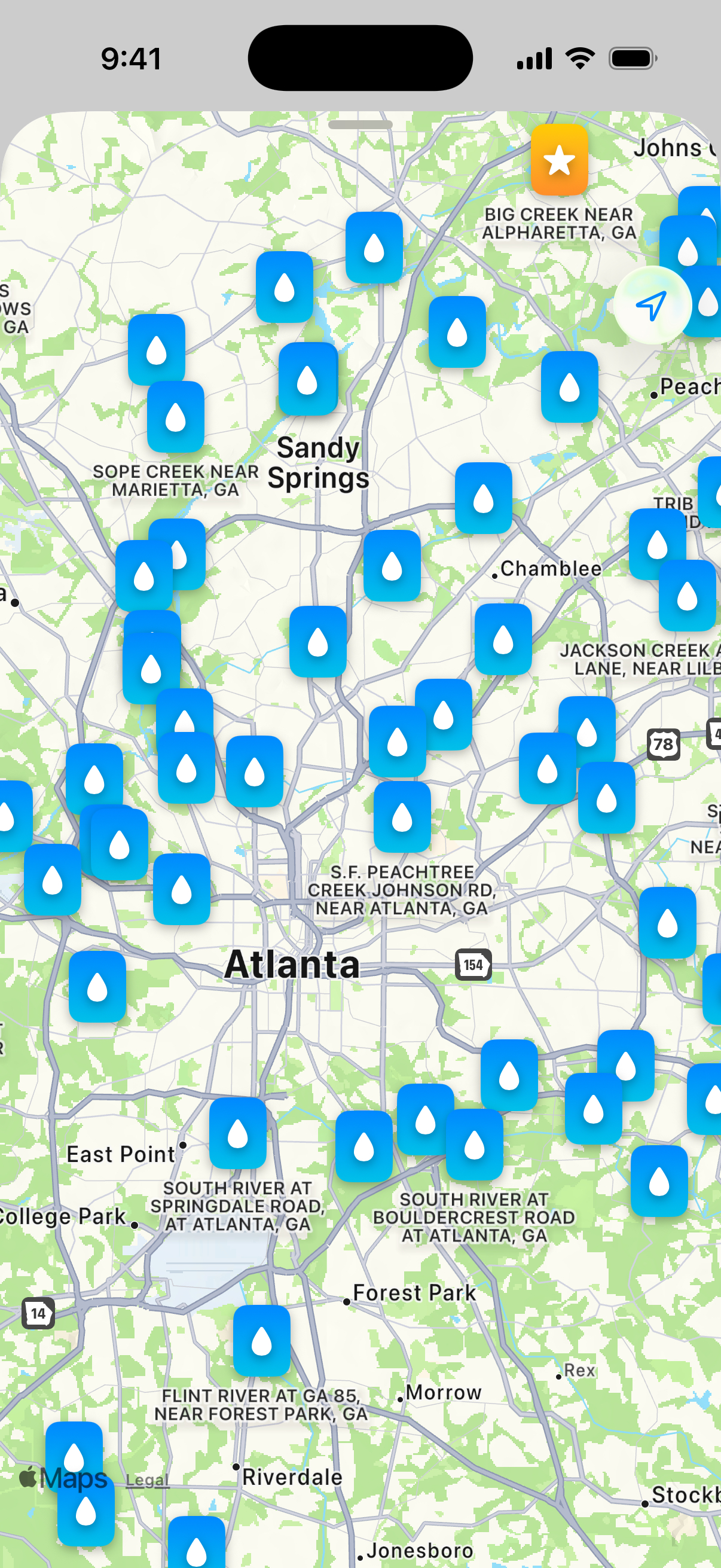
Interactive Maps
Explore thousands of stream gauges on an interactive map. Find gauges near you with location services.
Free to Use
Free and ad-supported. Optional in-app purchases available to remove ads and support development.